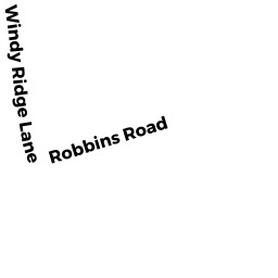
22 ROBBINS RD
Owner Information
KORCH IRREVOCABLE TRUST (10/13
22 ROBBINS RD
CHARLTON, MA 01507


Property Details
22 ROBBINS RD is classified as a Mixed Use (Primarily Residential, some Agriculture) (Old style).
The primary structure on this property was built in 1932. There are 1,438ft2 of built area within this property. There is 1,438ft2 of residential/living space within this property. This property is listed as having 6 rooms.
22 ROBBINS RD is valued at $203,365. The land is valued at $90,365 and the structures are valued at $102,500. There is an additional valuation of $10,500 on this property.
The most recent deed for 22 ROBBINS RD is recorded at the local registrar in Book 51608, Page 175. 22 ROBBINS RD was last sold on Thursday, October 10, 2013 for $1.
Assessment data from fiscal year 2022.
Flood Data
According to the FEMA National Flood Hazard Layer, this property does not appear to be in a flood zone. It may also be in an area not yet reviewed. Nonetheless, confirm this information prior to taking any action.
To view the flood hazards around this property, create a FEMA "Firmette" Map of the area around 22 ROBBINS RD.
Broadband Internet Providers
| Provider | Type | Bandwidth (mbps) | |
|---|---|---|---|
| VSAT Systems, LLC. | Satellite | 2 | 1 |
| Viasat Inc | Satellite | 100 | 3 |
| Verizon New England Inc. | DSL | 5 | 0 |
| Charter Communications Inc | Cable | 940 | 35 |
| T-Mobile | Fixed Wireless | 25 | 3 |
| GCI Communication Corp. | Satellite | 0 | 0 |
| HughesNet | Satellite | 25 | 3 |
Broadband service provider data from December 2020.
Adjacent Properties
- 9 ROBBINS RD
Single Family Residential owned by THIBAUDEAU FAMILY TRUST (1/09) - 6 WINDY RIDGE LN
Two-Family Residential owned by BACA GLORIA J (2/10) - 4 WINDY RIDGE LN
Single Family Residential owned by HOFFMAN LINDA L - 44 KING RD
Single Family Residential owned by MAURICE (DURLING DAWN P (9/02) - 8 A VINTON RD
Single Family Residential owned by LYMAN JAMES (4/05) - 10 A VINTON RD
Single Family Residential owned by HEYWOOD JAMES L (12/01) - 12 A VINTON RD
Single Family Residential owned by COLBY ANDREW J (4/02) - 20 A VINTON RD
Single Family Residential owned by AHMAD NASIR ALI BHATTI (9/17) - 16 A VINTON RD
Single Family Residential owned by ABRAHAM ABRAHAM V (4/10) - 14 A VINTON RD
Single Family Residential owned by LAWENDOWSKI ANDREW (5/08) - 22 A VINTON RD
Single Family Residential owned by STEWART DAVID L (10/06) - 0 KING RD
All land designated under Chapter 61 (not classified as Open Space) owned by GORMLEY KATHERINE - 0 SANDERSDALE RD
Undevelopable Residential Land owned by SERAPHIN JOSEPH (8/21 - 0 SANDERSDALE RD
All land designated under Chapter 61 (not classified as Open Space) owned by GORMLEY KATHERINE - 87 SANDERSDALE RD
Single Family Residential owned by BONCI GINA M (8/20) - 83 SANDERSDALE RD
Single Family Residential owned by GRENIER RAYMOND G (3/05) - 73 SANDERSDALE RD
Single Family Residential owned by LARIVIERE RITA S (11/02) - 12 KING RD
Single Family Residential owned by KIMBALL BENJAMIN (9/20) - 10 WINDY RIDGE LN
Single Family Residential owned by FLYNN GREGORY J - 16 WINDY RIDGE LN
Single Family Residential owned by FAUBERT MICHAEL E & DAWN MARIE (10/21)